
Upper Boston Post Road Entry #3 (UBPR#3)

“Sudbury Road, now Main Street, early laid out as a principal thoroughfare to the western settlements, extended through the comparatively uninhabited plain, important only as a means of communication to distant regions. The fact that the territory was unsettled doubtless accounts for its generous width and straight direction…”
Nathan Warren, in History of Middlesex County, 1890.1Nathan Warren, in Chapter XLV, Waltham, of History of Middlesex County in Three Volumes, Edited by D. Hamilton Hurd. Philadelphia: J.W.Lewis & Co., 1890. Volume III, p. 701.
As I might have mentioned in the last entry, the fifty acres of Gore Estate sprawl across the border between Watertown and Waltham. The liminal quality of that entry resulted from both the siren-like call of the lovely and interesting Gore Estate as well as the relevance to this project of the narrative of the spies Browne and DeBerniere’s visit to nearby Brewer’s Tavern. Instead of advancing as usual along the Boston Post Road through the next town, I was detained at the border, drifting through time but not through space. The nature of this project, as can be discerned from the title, requires walking in order to be successful. Much like a great white shark, I must keep moving forward or the project will die.
So, tinged with no little regret at having to leave the bucolic surroundings, I plunge into Waltham, Massachusetts. As if I needed a sign that I have embarked on a quixotic endeavor, five minutes walk through a modern suburban landscape brings me to St Jude Parish Church, the patron saint of lost causes. I would prefer St. Christopher; perhaps he is somewhere down the road.
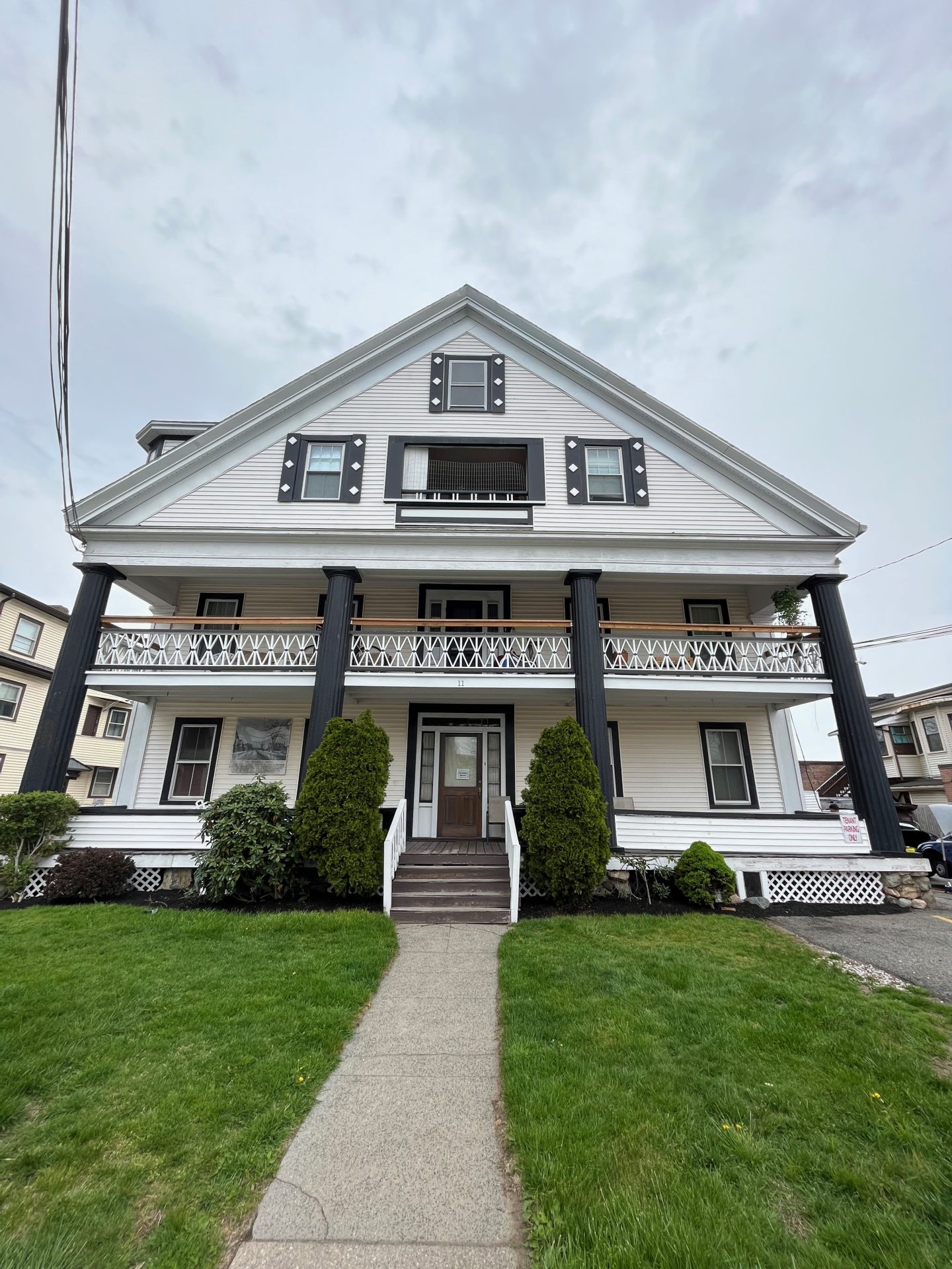
Almost immediately after passing the church it all goes downhill. The road, that is, which begins a surprisingly sharp drop down to Beaver Brook. Most of the buildings along this stretch of road date from the last century. One of the few houses of note is a slightly older mansion in the Queen Anne style from 1890 at 176 Main Street. A map of the area from 1900 shows that a mere handful of estates comprised the lion’s share of the land along the half-mile of road between Grove Hill Cemetery and Gore Place. The aforementioned Victorian house, built for a lawyer named Robert Stark, is one of a cluster of ‘newer’ houses visible on the map that were part of a development on one of the large properties that clearly presaged the fate of the adjacent estates during the course of the twentieth century, with the notable exception of the Gore Estate.
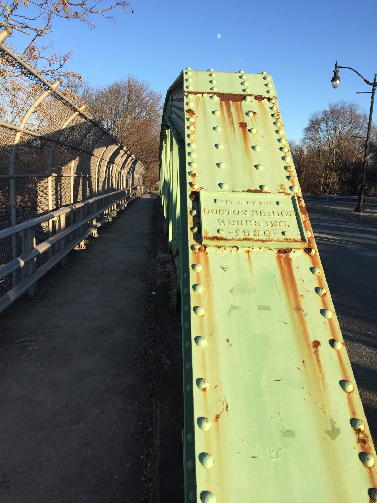
The aptly named Grove Hill Cemetery, dating to the early eighteenth century, rises steeply on the left, while the road continues its descent to Beaver Brook. At least the road would have dropped down to meet Beaver Brook until 1936, when a bridge was built over both Beaver Brook and the tracks of the Boston & Maine Railroad (today’s Fitchburg Line on the Commuter Rail). The reconstruction of the road shifted the route of what was then called Boston Post Road 120 feet eastward; the former route is still present today in the form of Massasoit Street, which descends to the railroad tracks before veering sharply left. Prior to 1936 the road crossed over Beaver Brook on a small bridge (shown on the 1775 map of our fellow traveler Ensign Henry DeBerniere) and then crossed over the tracks at grade (at least from 1844 when the tracks were laid). A Boston Globe article from 1931 wrote “this is considered one of the worst crossings in the State and it holds a preferred position on the list of grade crossings which the State plans to eliminate in its State-wide program.”2Boston Globe July 3, 1931, p. 4. https://www.newspapers.com/clip/58813890/the-boston-globe/ A fence now blocks the way across at the site of the long gone Beaver Brook Station. Across the tracks is a lumber yard through which the old road would once have traversed; beyond the lumber yard a little lane which once was also part of the Post Road runs from Main Street back down into the lumber yard to complete the short detour, before Main Street and the old Boston Post Road once again are one and the same. I squeeze through a gap in the fence, cross the tracks safely, and cross the lumber yard parking lot to reconnect with the lane on the opposite side. Not the most exciting adventure (I did warn you last time!), but in the interest of hewing to the original route as closely as possible I boldly brave the dangers. Interestingly, I don’t have to cross Beaver Brook as it disappears into a tunnel upon reaching the north side of the distinctively New Deal-style bridge (apparently the first bridge built under the auspices of the Works Progress Administration)3Boston Globe October 21, 1935, p. 7. https://www.newspapers.com/image/?clipping_id=75921091&fcfToken=eyJhbGciOiJIUzI1NiIsInR5cCI6IkpXVCJ9.eyJmcmVlLXZpZXctaWQiOjQzMTkwNjQ3OSwiaWF0IjoxNjUxMTc4ODA2LCJleHAiOjE2NTEyNjUyMDZ9.dX5M4AxEMYLEt4YQ0NpQ-nR1mS1BhJ9lvQuHfE-YHjs, never again to reappear above ground until it disgorges into the Charles River half of a mile south of the Post Road. The bridge was clearly meant to cross over the tracks and not over the brook.
*****
The next half-mile along the road has a range of interesting buildings from various periods befitting a road more than three centuries old. Among the many possible choices, three buildings of starkly different character particularly appeal to me. Just past the bridge is the intersection with Linden Street (Route 60) which leads northeast to Belmont. Easily visible from the bridge over Beaver Brook, at 34 Linden Street, is the striking building housing Waltham District Court, designed by Charles Greco and built in 1938-40. The large ornate lamps flanking the staircase, the imposing flat stone columns that rise up the entire facade, the large windows between the columns comprised of glass bricks, and the unique ‘1930s’ font carved into the stone facade identifying the building as the ‘Second District Court of Eastern Middlesex County’ all support the claim on the application submitted for recognition on the National Register for Historic Places that the Courthouse is “Waltham’s most full-blown example of the Art Deco Style.”4Massachusetts Historical Commission ID# WLT.515. https://mhc-macris.net/#!/details?mhcid=WLT.515

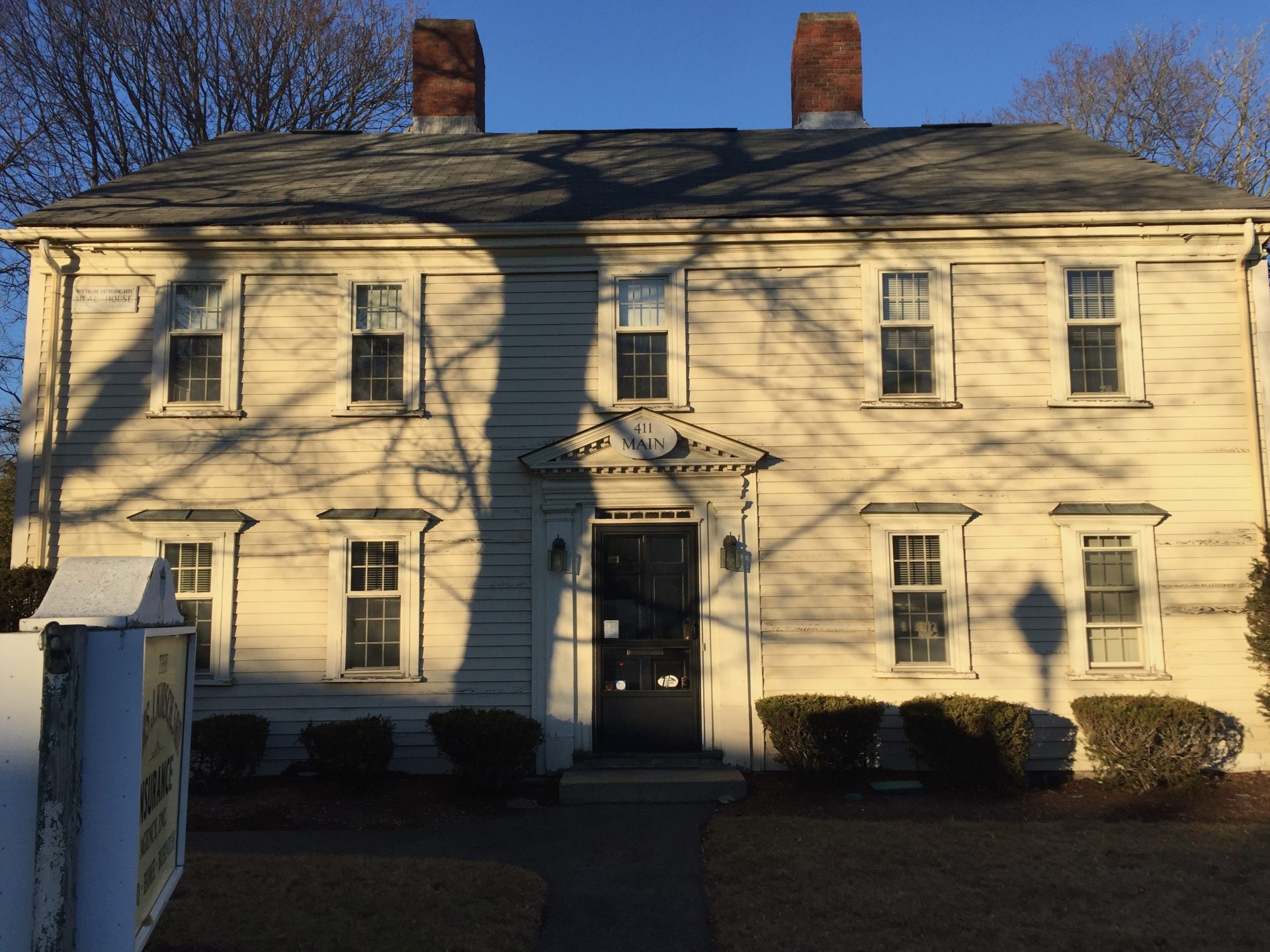
Immediately beyond Linden Street is an insurance agency housed in what is clearly an old house at 411 Main Street. On my first visit through this area there was a weathered plaque on the facade describing this as the Hager-Mead House dating to c. 1795.; the sign had disappeared on subsequent visits. Fortunately I came across a great little pamphlet from the Waltham Historical Commission entitled A Sampler of the Historic Sites along the Old Boston Post Road in Waltham, which confirms both the names of the owners and the year the house was built.5 This pamphlet in turn lead me to a more substantial booklet published by Morton Isaacson, a member of the Waltham Historical Society, A Ramble Through Waltham’s History on the Great Country Road. This booklet confirmed for me what I had already suspected about many of the structures I encountered during my peregrinations along the road and is a great resource for somebody specifically interested in Waltham’s history. This building, as with the Courthouse and the following structure, are all on the National Register of Historic Places.6 Massachusetts Historical Commission #WLT190 https://mhc-macris.net/#!/details?mhcid=WLT.190
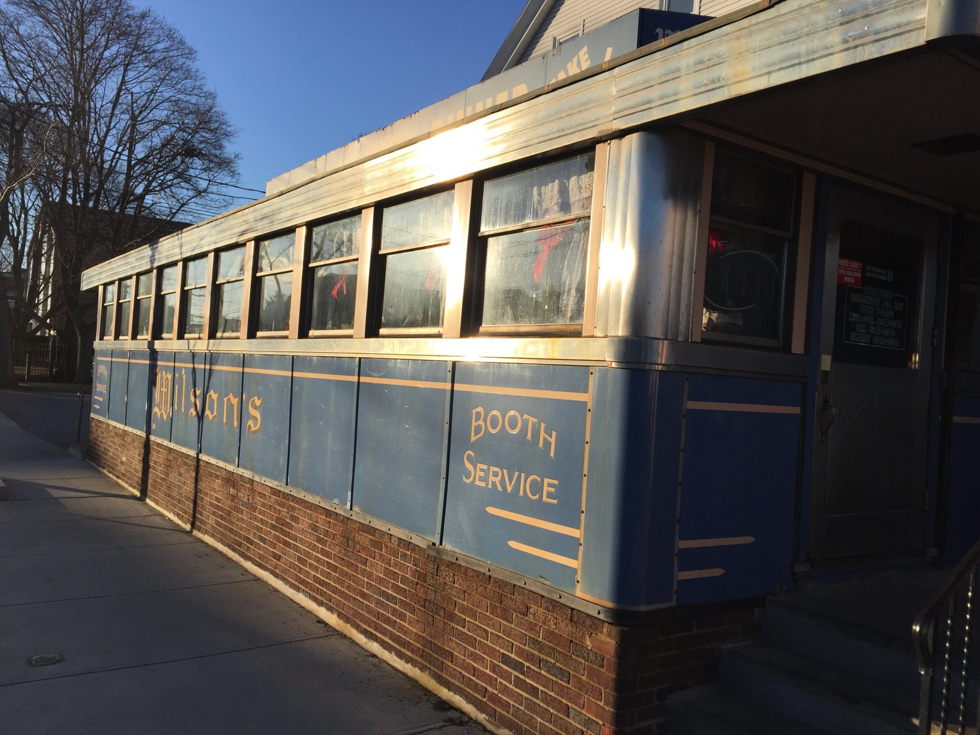
The road ahead, unlike the walk thus far from Boston, is surprisingly flat for the next 1.5 miles. A map of the Boston area from 1775 by J. DeCosta refers to the area as ‘Watertown Plains’ but John Hales’ map of Waltham from 1831, a more detailed and accurate map, calls the area by its more appropriate name, ‘Waltham Plains’. At Newton Street just ahead I pass a sign welcoming me to Waltham, despite the fact that I have been in Waltham for over a mile already. The road becomes noticeably busier with both residential and commercial architecture, including a few interesting nineteenth century houses. However, the ‘building’ that catches my eye is the gleaming blue porcelain enamel-clad Worcester Lunch Car Company Diner #819, better known as Wilson’s Diner.7 Once again I have to mention the excellent book by Larry Cultrera, Classic Diners of Massachusetts. Also Massachusetts Historical Commission #WLT.BC p. 11 of the report. https://mhc-macris.net/#!/details?mhcid=WLT.BC The diner, opened in 1949 and appended to the front of the building at 507 Main Street, is another in what I anticipate to be a series of diners to be found along the road, principally built in the mid-twentieth century in Worcester, that for some reason fascinate me. I (of course!) stop in for lunch, which is standard diner fare to be honest, but I am really here to appreciate the well-preserved interior with its long marble counter and bar stools running the entire length of the dining car, to appreciate the cozy wooden booths lining the front, to appreciate the old diner clock and the memorabilia lining the few wall spaces available, to appreciate the amazing skill required to work so smoothly in such tight quarters. Of course the friendly people running it are Greek, of course they took over the place just before the pandemic, and of course they worked their tails off to keep it going through that dark period. How pleasing it is to be sitting at the counter as one elderly couple after another strolls in to be greeted warmly by the owners who welcome them back graciously after not seeing many of them for two years. That is the part I appreciate the most. σας ευχαριστώ!
It is only a couple of minutes from Wilson’s Diner to Waltham Center. The busy Central Square Historic District, the area around City Hall, which sits on a pretty Common that slopes down toward the river, is lined with interesting nineteenth century commercial architecture and the roads in every direction are filled with traffic. Waltham became a sizable city as a direct result of the demand for workers at the many factories that lined the river in the nineteenth and early twentieth centuries. A few yards from the Common at the foot of Moody Street is a large waterfall along the Charles River that played a major role in the industrial development of Waltham, Massachusetts, and of the United States. The water power resulting from the ten foot drop of the river became the catalyst for the establishment of the Boston Manufacturing Company, the first integrated spinning and weaving factory in the world for the production of cotton textiles and the factory that catalyzed the Industrial Revolution in America.

The Boston Manufacturing Company was established in 1813 by Francis Cabot Lowell, who memorized the details of power looms he had visited in Lancashire with the intention of establishing a large scale domestic textile industry using cotton grown by enslaved people in the American South. Financing was provided by a group of local wealthy worthies known as the Boston Associates, among whose number was Christopher Gore, the subject of the previous entry. These ‘associates’, like Lowell himself, mostly came from the same families later lampooned as ‘Brahmins’ by Oliver Wendell Holmes and the subject of the famous doggerel
And this is good old Boston,
The home of the bean and the cod,
Where the Lowells talk only to Cabots,
And the Cabots talk only to God.
The factory is long gone (closed in 1930) but some of the old buildings remain along the banks of the river adjacent to Moody Street, today serving a variety of purposes, including a home for seniors, an arts center, and the Charles River Museum of Industry and Innovation. Lowell and his associates, including Amos Lawrence, used the success of this first venture to build even bigger mills along the larger and more powerful Merrimack River, establishing the cities of Lowell and Lawrence in the process. The success of the Boston Manufacturing Company attracted others who wished to set up industrial enterprises. The most significant of these was the Waltham Watch Company, which dominated nineteenth century watch production in America. Waltham is to this day nicknamed ‘Watch City’ because of its association with the production of timepieces.

The factories on the Charles River required labor and this led to a rapid increase in the population of Waltham and the transformation of the heretofore rural town of farms and country estates (the ‘comparatively uninhabited plain’ of Warren’s quote above) into the large multicultural city it is today. The first workers were young women from farms around New England but this source of labor was soon found to be insufficient and before long large numbers of first Irish immigrants and ultimately workers from Italy and other European countries filled the factory floors. The early establishment of an ethnically diverse community doubtless is the reason Waltham remains so diverse today.8For more on the history of various immigrant populations see Kristen Petersen with Thomas Murphy, Waltham Rediscovered: An Ethnic History of Waltham, Massachusetts. Portsmouth, NH: Peter Randall, 1988. For example, of the 65,218 residents of Waltham counted at the 2020 Census, 39.6% are non-White, higher then the 30.0% of Newton, Waltham’s neighbor across the river, or of Watertown to the east (26.9%). Additionally 26.6% of the population is foreign-born, also higher than its nearest neighbors. Waltham has changed quite a bit in just 10 years: in the 2010 Census only 31.2% of the population was non-White, an increase of close to 7,000 people.

With the exception of Worcester (5527 inhabitants/mile2), Waltham, at 5119 inhabitants per square mile, is also the most densely populated city or town along the Boston Post Road from this point until the road reaches Hartford, Connecticut (6965 inh./mi2), although all of the towns and cities ahead along the road through to the outskirts of New York City are less densely populated than Watertown (8832 inh./mi2), the previous town discussed in this project. Incidentally, Waltham is more densely populated than Houston (3,599 Inh/mi2), Phoenix (3,105), San Antonio (4,256), and Dallas (3,841), all ‘top ten’ cities by population in the United States. The larger ‘city’ of Boston, including the actual city plus the inner, more urban towns and cities enclosed by the beltway of Route 128 has a population density around 6,000 residents per square mile, comparable to that of Waltham. This ‘Boston 128″ would be the 4th or 5th largest city in the United States, with about the same population as Houston but would be almost twice as densely populated. ‘Waltham Plains’ is certainly no longer ‘comparatively uninhabited’ as described above. We are still in the gravitational pull of Boston, but not for much longer.
The bottom of Waltham Common, before the Charles River is reached, is a transportation hub for the MBTA. The Waltham stop on the Fitchburg Line of the MBTA Commuter Rail passes through here while across the street from the train tracks is the terminal stop for many of the express buses that travel from Boston to the immediate western suburbs. Only MBTA Bus Route # 70, which runs along the Post Road for much of its route through Watertown and Waltham continues west from this stop, terminating just short of Route 128 (Interstate 95), the beltway that encircles the two million inhabitants of Boston and its larger inner suburbs. Once beyond Route 128, aside from the Commuter Rail, MBTA service effectively ends and the walk transitions into an area essentially bereft of public transportation for miles. Unsurprisingly, the population density of the towns in these outer suburbs drops dramatically.

The establishment of Waltham Common dates to the 1830s as Central Square in Waltham became the center of town only as a result of the factories on the river. Most of the buildings of interest along this stretch of the Post Road are, unsurprisingly, of nineteenth-century origin, including the impressive Italianate three-story red brick Central Block (1856), directly opposite City Hall (1926) on Main Street. A little further along Main Street are two interesting church buildings, Trinity Church (1870-71), the descendant of the original Congregational church which established Waltham as a town separate from Watertown in 1738. Congregationalists are in short supply these days; today the building is the home of the New Light Korean Church, to give one example of the Waltham’s diversity. Nearby is the lovely Christ Church Episcopal (1897), made of field stones reputedly donated by the owner of another Waltham Estate, Robert Treat Paine. Directly across the street, Waltham’s library is housed in the substantial Georgian Revival Francis Buttrick Library Building (1915).
The next half-mile along the road from the Library to the junction with Route 117, at which point the Post Road leaves Main Street and continues along the aptly named Weston Street to the eponymous town, is a very busy commercial area with little of historic value or cultural interest to keep me for long. Or so I think. Yet hidden away from Main Street at 11 Hammond Street, directly behind Lena’s Sub shop, is a Greek Revival building from 1839 which, according to the Waltham Historic Commission brochure, was “the last structure remaining that was built as a stage coach inn along the Boston Post Road in Waltham.” Originally facing Main Street, ‘Prospect House’ was rotated to face Hammond Street in the early 1909, presumably so they could jam another commercial building along Main Street in the space created. It never fails that there is always one tidbit hiding in these otherwise unremarkable stretches.
The area right around the junction of Main, South, and Weston Streets continues to be very commercial and very busy but there is much more of interest directly related to the Post Road at this intersection. The Main Street extension was laid out after 1819 as it does not appear on Hales’s map of that date (see map at the end of the entry) but is present on Hales’ updated map of 1829, as well as on a map Hales did specifically of Waltham in 1831. The Main Street extension connected to the old road to Lincoln as we shall see shortly. South Street is a very old road as well, but Weston Street is the route of the Upper Boston Post Road.
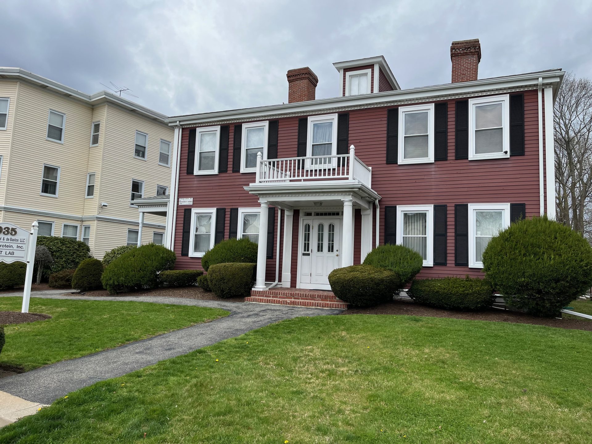
On the right hand side of the road as I walk west, at 935 Main Street, is a large Federal building, the Gale-Banks House, built in 1798 for Jacob Gale. Originally a farmhouse, in 1855 it became the home of Nathaniel Banks, Republican Congressman, Speaker of the House, Governor of Massachusetts, and very poor Civil War General. To think that the houses of two people who each served as Governor of Massachusetts (Gore Place, home of Christopher Gore, is where the walk began) and were both important figures in national politics can be found along one short stretch of road in Waltham, Massachusetts. The Post Road is the gift that keeps on giving! Unlike Gore, who was born a ‘Brahmin’, married into a banker’s family and was one of the early investors in the mills that would transform Waltham and the United States, Banks started out as a worker in the same textile mills of Waltham at the age of fourteen, was self-educated, and worked his way into politics. Surely there is a metaphor in here about America and the land of opportunity.

Directly across the street from the Gale-Banks House, just at the beginning of Weston Street, are two markers of interest related to the Post Road. First is a stone marker indicating the route Colonel Henry Knox took from Fort Ticonderoga to Cambridge with his train of artillery that proved so decisive in forcing the British Army to evacuate Boston in 1776, another in the series of plaques we have already encountered in both Cambridge and Watertown. A second adjacent plaque, embedded in a large millstone, is another in the sequence of plaques dedicated to George Washington, again similar to ones seen in Watertown and in Cambridge. I must still be following the correct route!

Weston Street, for the first quarter of a mile, continues the theme of highly commercial development along this stretch of the Post Road. I suspect part of the reason the Post Road west of Waltham Center is so much more developed than the Post Road east of the center has something to do with its proximity to the neighboring towns on the other side of Route 128 (Interstate 95) from Waltham. Lincoln and Weston are two of the richest towns (as measured by per capita income) in Massachusetts. Weston is, in fact, number 1 as we shall see in the next entry, but Lincoln is no slouch at #13. Neither town cares much for commercial development (I read somewhere that you can’t buy a lottery ticket in Lincoln but can’t swear that is true!), and both towns are primarily residential with lots of open space as befits places that are highly desirable. However, people with that much money need to buy things (like lottery tickets!) and Waltham is handily nearby.
Hills loom on either side of the road, and it is apparent that I have ‘crossed the plains’ as the road begins to ascend. I also leave the unsightly commercial area behind as more and more houses line the road, including one or two impressive Victorian mansions. Up a steep slope at Caldwell Street is the Greek revival Edwin C. Johnson house from 1847-1853. Hidden away in plain sight a little further along at 244 Weston Street is the Smith-Jones house, the oldest surviving house on Weston Street, from 1774, which was moved at some point from the opposite side of the road. As the Waltham Historical Commission guide puts it “It…very likely witnessed the passage of General Gage’s spies on their way from Boston to Concord in 1775.” It looks as if a lot of things have been done to it over the years and I would be hard-pressed to say it looks anything like a colonial-era building, but apparently it is.
The road winds uphill to reach a junction with Stow Street, the original road to Lincoln before the Main Street extension was built. This intersection is shown on Hales’s 1819 map and also on the map made by the aforementioned spies in 1775. Also shown on the DeBerniere map at this junction are two taverns. Today there is a complicated triangle of streets surrounding a Sunoco station and a daycare center (alas no tavern). The third road in this triangle is the short curve that connects the other two, intriguingly called Tavern Road. Using the older maps as a frame of reference, it is clear that the short curve of Tavern Road was originally part of the Post Road before a shortcut was pushed through sometime between 1831 and 1854. More evidence for this conclusion appears at the far corner of the triangle, where Tavern Road meets Weston Street. In a grassy patch dividing the roads sits a stone marker indicating the passage of George Washington on his way to taking over the ‘Patriot’ Army in 1775 (see the photo at the beginning of this entry).

Immediately after rejoining Weston Street from Tavern Road the road begins to descend and the distant roar of traffic from Interstate 95 becomes noticeable; three minutes later I reach the edge of the complex interchange between the interstate highway and Route 20. Traveling the original route through this area is complicated by the fact that construction of Interstate 95 and the exit ramp leading to Weston Street (Route 20) changed the layout of the roads. Just before the tangle of roads leading on and off the highway, Sibley Road forks left away from today’s main road (Weston Street) and meanders downhill towards Stony Brook, the boundary between Waltham and Weston. Sibley Road was the original road, and travelers would cross the brook on a small bridge to reach Weston on the opposite bank. However, as is apparent on the maps below, the top of Sibley Road has been changed from its original configuration. I knew this must be true when I first walked this road and it began by going uphill before descending steeply, which made no sense and was inconsistent with any of the old roads I have previously followed. It turns out that the original top of Sibley Road is today that part of Weston Street from the beginning of ‘New’ Sibley Road up to the point where Weston Street intersects with the first exit road from the highway. Standing at this junction of Weston Street (Route 20) and the exit ramp from I-95 Northbound exit 41, looking left over the fence adjacent to the sidewalk down a steep embankment, today’s Sibley Road is visible at the base of the embankment. The original road would have descended across this embankment area, albeit less steeply, to connect with what is left of the original Sibley Road. Today, looming over the original road, is the multi-lane Interstate 95, better known to Bostonians as Route 128, the ring road around Boston and the inner suburbs. The old road, Sibley Road, now ends in a cul-de-sac, and it is impossible to traverse the 472 feet to what remains of the old road on the other side of the three barriers of brook, highway, and train tracks, so back up the hill for one third of a mile I go to continue on Weston Street through the busy on ramps and off ramps of 128 for another third of a mile to reach the point where the newer road connects with the older road in what is now Weston. 9 Out of curiosity, I measured the area that the entire interchange (Exit 41) takes up, from the beginning of the exit ramps to the final junctions with Route 20 (Boston Post Road/ Weston Street). The total area is about 45 acres, which is nearly the area of the Gore Estate. Is it any wonder that so few places like Gore Place or the Lyman Estate still exist considering the vast amount of space dedicated to a single interchange on a single highway?

The old route on the Weston side of Stony Brook is today a short dead end road leading to Lucas Irrigation and the Weston Shooters Club before reaching the fence protecting the train tracks of the Fitchburg Commuter Rail line. The trains still pass on their way to Concord or Boston but gone is the former Stony Brook station that stood near this spot until 1960. Returning to the main road I turn left and head west along Route 20, which here in Weston is officially called, for the first time, Boston Post Road. The city of Boston, whether the official city of 48 square miles and close to 700,000 residents or the conglomeration of more than 300 square miles and two million inhabitants held within the curved confines of Route 128, is now behind us.10From the Wikipedia entry on Route 128: “In local culture, ‘Route 128’ is generally recognized as the demarcation between the more-urban inner suburbs and the less-densely-developed suburbs surrounding the city of Boston. It also approximately delimits the region served by the rapid transit and trolley system operated by the Massachusetts Bay Transportation Authority (MBTA). We are beyond the city and into the suburbs. The journey has truly begun.

Above is a map of the Route 20/Interstate 95 interchange. At left is a detail from Sanborn’s Fire Insurance Map of the area from 1918. The original Boston Post Road from Waltham center for the most part (with the exception of the short segment along Tavern Road,which is the curved road around the Discovery Village Child Care Center) followed Weston Street. The old route then followed Sibley Road down the hill, crossed Stony Brook, and then curved back up the hill on the Weston side. The curve of Sibley Road was shortened in the late nineteenth century by an extension of Weston Street, but the real transformation came in the mid-twentieth century, first in 1936, when the at-grade crossing was removed as part of the same project that transformed the road at Beaver Brook, and later in the 1950s when the roads were reconfigured more drastically with the construction of the highway. The upper portion of Sibley Road was moved a few yards south from its original route. This can be shown using the Sanborn map, which shows individual property lots in 1918 and comparing them to the extant lots today. ‘New’ Sibley Road today starts at the purple line between Florence Road and Weston Street and cuts through the lots that formerly flanked the south side of the original Sibley Road to a point just past Westgate Road on the Sanborn Map, where it connected to the remaining section of the original Sibley Road. The original top half of Sibley Road is now Weston Street up to the intersection with the exit road from I-95 (about where the first arrow is located on the Google map above). Today a steep embankment has been built over the old road at this point but the old road is still present at the bottom of the embankment as the bottom half of Sibley Road up to the cul-de-sac shown on the map (a private road continues southeast from the cul-de-sac as a continuation of Sibley Road but this is NOT part of the old road). The old road would have continued west across Stony Brook under today’s highway but a fence blocks access. On the Weston side, the road is not shown on the Google map but it is a lane that leads down the hill to Weston Shooter’s Club just past the Dunkin Donuts. A fence blocks any further progress across the train tracks over Stony Brook and under Route 128 (Interstate 95).


Distance traveled for this entry: 3.4 miles.
Distance traveled from Old State House : 14.2 miles.