

“When we had Ridd about an how’r, wee come into a thick swamp, wch. by Reason of a great fogg, very much startled mee, it being now very Dark.”
Sarah Kemble Knight
from the Journal of Madam Knight.
October 2, 1704.
***
This is entry #13 from my previous project, Walking the Post Road. I have been slowly transferring the entries over to this project for a number of reasons. The first reason is that they are relevant to this project in that the first dozen or so are ‘rambles’ about Boston. Even the entries that are not about Boston are about the Boston Post Road. Indeed, writing about places outside of Boston gives me a fresh perspective which is useful when I am writing about Boston. The main reason, however, is that the previous project was done on Apple’s iweb, which is no longer supported by Apple and, consequently, the website is slowly decaying. I will eventually revisit that project and bring the entire site up to date. In the meantime readers are welcome to comment upon this entry as part of this project. It has been updated and edited slightly from the original version which was published on Tuesday, June 15, 2010, as entry #13, Mile 11.
*****
Sarah Kemble Knight traveled from Boston to New York in the fall of 1704, stopping in New Haven to settle some family business. Forty years later Dr. Alexander Hamilton of Annapolis, Maryland traveled through the colonies north of Maryland. He ventured as far as Albany in New York and also visited Boston, continuing on to what is now York, Maine, before returning to Boston, then returning to Annapolis. Both traveled the New York to Boston route along the Connecticut coast, through Rhode Island, and both passed through Dedham, stopping in the same tavern, known as Fisher’s tavern at the time (see the previous entry for more on this tavern). Their routes were the same for the most part, but here in Dedham they diverged, a product of improved roads in Hamilton’s day. Hamilton was a leisure traveler, and his trip included all the major towns along the route. Newport Rhode Island was the largest town in Rhode Island before the Revolution, and thus his route was determined in part by a desire to visit Newport.
Knight traveled for business purposes and rode with the postal rider as a guide. The postal rider’s main interest was the shortest and fastest route. Thus Knight bypassed the Newport route in favor of traveling along the western side of Narragansett Bay, via Providence, a less populated and more treacherous route as she describes in her diary. She also traveled the older road from Dedham to North Attleboro, an old Indian trail, which was eventually bypassed by a shorter route that went through Wrentham and Walpole instead of Sharon and Foxborough. I have drawn a map of each of their routes which I will fill in with more detail as I travel along the route.
The main issue before me is which route to follow. Both are valid as the main routes of their time, but they differ significantly for a total of about 40 miles, primarily in Massachusetts and Rhode Island. The solution? I will follow both! First I will follow Knight’s route to North Attleborough, then in the next entry I will follow Hamilton’s route via Wrentham to Slack’s tavern in North Attleborough, which Knight may have visited as well.
*****
Mile 11. East Street, Dedham, Massachusetts.
Leaving Dedham center I walk on High Street, under the Route 1 overpass, to East Street and continue walking down East Street. The oldest settled part of Dedham was along this road which was slightly elevated relative to the more waterlogged areas that made up a large part of this area in the seventeenth and eighteenth centuries. Referred to on old maps of Dedham as the “four rod highway,” the old trail connected Massachusetts Bay to Narragansett Bay and was referred to in the early days of English settlement as “the Old Roebuck Road.” The fact that in 1704 Knight arrived in Dedham to “meet ye Western Post” clearly indicates that it served as a Post Road as well. In future entries I will return to the issue of what a “Post Road” is and which route was “The” Post Road. Here I will say only that the first postal rider from New York to Boston, in 1673, did NOT travel this route, but rather traveled via Hartford and through western and central Massachusetts, which has come to be known as the “Upper Post Road.” This early post was quickly terminated upon the commencement of hostilities with King Philip and his allied Indian tribes during the so-called “King Philip’s War” which began shortly after this first postal rider made his journey. I will add here that Boston and New York, while the largest towns in colonial America, were not the only towns of importance and that many of these towns lined the coasts between New York and Providence. Newport, for instance was the fourth largest colonial town in 1720 and as late as 1790 was the seventh largest town in the United States. Thus this route, which even today is the major commercial artery of New England, was an early and important road in America.
A few minutes walk along East Street brings me to one of the most arresting sites on my journey thus far. The Fairbanks House is reputed to be the oldest surviving timber frame house in America (I assume as opposed to an adobe house or wigwam), and it looks exactly as if it was a movie set for the Scarlet Letter. The land was granted to Jonathan Fairbanks in 1637, and the house was built shortly thereafter. It is fair to say that this was a “frontier house” situated as it was in the middle of thick woods and seemingly impenetrable swamp. Even today, the area behind the Fairbanks house is primarily woods and water. In 1638, the seven-year old son of John Dwight wandered into these woods and disappeared, presumed to have been eaten by wolves. A ten shilling bounty for wolves was offered and between 1650 and 1672 seventy-two wolves were killed in Dedham alone!1Robert B. Hanson, Dedham, Massachusetts, 1635-1690 (Dedham Historical Society, 1976), 52. To be fair though, at the time Dedham comprised a very large area south and west of its current borders, including the area that are today the towns of Westwood, Norwood, Walpole and many others. Still, that is a large number of wolves.
The 10.6 square miles that comprise the contemporary town of Dedham are populated by 24,132 inhabitants (2007 estimate), a far cry from the 106 families of 1677 or the 438 people of the 1790 census, the first official census of the United States (this included what is today Norwood and Westwood). In the 2008 election, Barack Obama received 56% of the vote, but Republican Scott Brown received 55% of the vote in the 2010 special Senate election. We have entered the “red belt” of Massachusetts, such as it is, which consists of the suburban towns south and southeast of Boston that tend to be more conservative than the city and the western suburbs. The town is primarily suburban, with a long commercial strip lining US Route 1 which bisects Dedham. (2022 update: The population of Dedham at the 2020 census increased by over 1200 new residents, to 25,364. As for politics, the town is becoming much more ‘blue’ as are many suburban towns in America, caused at least in part by the toxicity of Donald Trump and the steadily rightward turn of the Republican Party. Joe Biden received 10,760 votes in 2020 (67.8%), over 3,000 more votes than Barack Obama in 2008, while Trump in 2020, with 4,771 votes (30.1%) received fewer votes than he did in 2016 (4,778) and fewer even than John McCain in 2008 (5,361) as well as having the lowest percentage of the vote since at least 1980, which is as far back as the records go to which I have access. Dedham is still not as liberal as the more urban cities like Cambridge, Newton, or Boston; Republican Charlie Baker won the Gubernatorial vote in 2010, 2014, and in 2018 with increasing margins each time. So a Republican can still win if they are perceived to have a certain level of moderation. Geoff Diehl, who does not fit the Baker mold at all, does not stand a chance in 2022. Not only did Diehl lose the Dedham vote to Elizabeth Warren by 59%-38% in the 2018 Senate race, Warren lost to Scott Brown in Dedham by 51%-49% in 2012, despite easily defeating Brown at the state level by 54%-46%. The ‘red belt’ is shrinking: every single town in Norfolk County voted for Joe Biden in 2020.)
*****
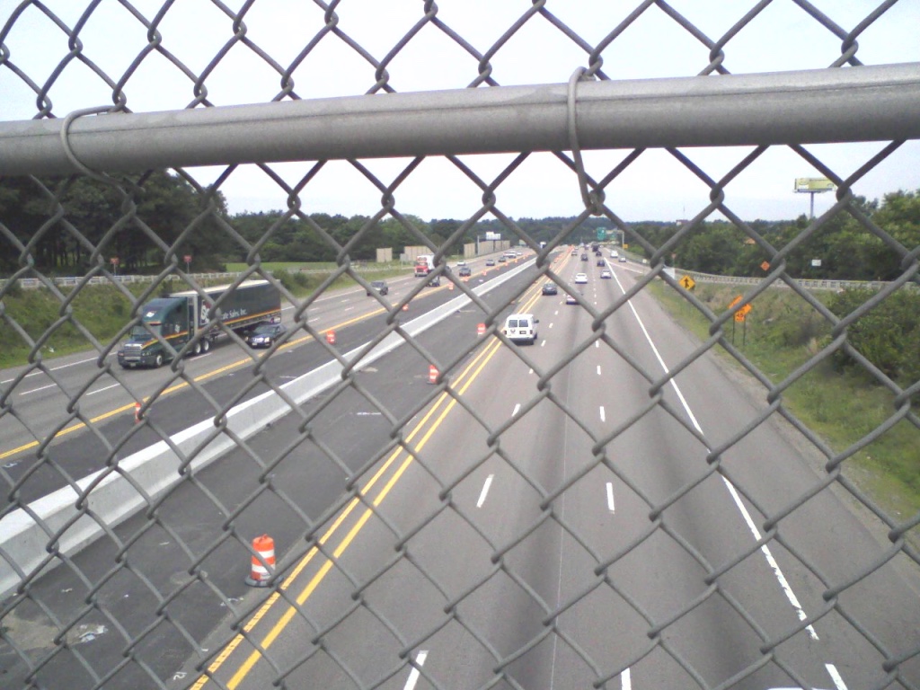
After an uneventful mile and a half walk along East Street, passing through a middle class neighborhood not unlike the one in which I grew up, I come to an interchange with Interstate 95, the highway which circumnavigates the city. Also known as Route 128 to locals, the highway was built in 1951 as the first circumferential highway in the United States. It also unofficially marks the end of the inner suburbs of Boston. As I make my way carefully across the entrance ramps, I am struck by the abundant vegetation which has sprung up on the fence and in the sidewalk cracks. I have recently read a magnificent book about “weeds” by Peter Del Tredici called Wild Urban Plants of the Northeast which has completely altered my perception of these hardy survivors. Del Tredici’s insights about the possible role of these plants in the battle against global warming is fascinating, and his description of the cultural significance of each plant makes me realize that one man’s weed is another man’s food. Crossing over Route 128 also brings me out of Dedham and into Westwood, formerly the Third Parish of Dedham. Also called Clapboardtrees, or West Dedham, the parish formed in 1730, but in 1897 it was the last of the many towns to break away from Dedham. Westwood is one of the wealthiest towns in the Boston metropolitan area and, with a mere 14,618 residents (2010 Census), is one of the most sparsely populated towns; comprising 11.1 square miles it is roughly half as densely populated as Dedham. (2022 Update: Westwood increased in population to 16,266 residents, a substantial increase which, in part, explains the frenzy of development around the East Street/Washington Street intersection, of which more below. Westwood is still one of the wealthiest towns in Massachusetts as measured by median household Income ($159,646 according to the Census Bureau). Dedham lags well behind ($101,780), Norwood is lower still ($90,341), while Boston is far, far behind ($76,298).

Five minutes after crossing over Route 128, I again bump into US Route 1, a route I will encounter for the entirety of my trip to New York. Originally called the Atlantic Highway and renamed Route 1 in the 1920s, this road became increasingly important with the rise of the automobile in the twentieth century. After Interstate 95 was constructed in the 1950s Route 1 was bypassed and has since served mainly as a commercial strip in most of the towns through which it passes. In places, especially in Connecticut, it is still known as the Boston Post Road, and we will revisit this road in future entries.
One half mile after passing Route 1 and three miles after leaving Dedham center, I arrive at the junction of East Street and Washington Street, Dedham. I have just crossed the railroad tracks of the Boston and Providence Railroad, and have now come upon the Boston to Providence Turnpike, which I have also encountered previously. The turnpike was constructed beginning in 1800 but was replaced in the 1840s as the major route of transportation by the arrival of the railroad, which was subsequently replaced by the automobile traffic which filled first Route 1, then Interstate 95. ALL of these routes were preceded by the road on which I am traveling. As these routes have all had their day of primacy as the principal means of transportation from Boston to New York, I will revisit the history of each in turn as I progress along this oldest of roads.

I turn left onto Washington Street, as the Turnpike was built over this short stretch of the old road. I know this is true as I stop in front of the Blue Hart Tavern, now a real estate office.2See the MACRIS entry for this building here. The tavern was built by Jeremiah Dean according to the report but I can find little evidence of it in history books or on old maps of the area. Nor did the Westwood Historical Society see fit to discuss it on its website. Curious. See below for an update on this building. The sign indicates the building dates from 1740, six decades before the construction of the Turnpike. Here I will stop, retrace my steps to Dedham Center, and travel the route Alexander Hamilton followed in 1744 to arrive at this same spot. Further along, Knight and Hamilton diverge again, and I will follow each of these roads as they each made their way to North Attleboro. Here in Westwood at least, all roads lead not to Rome but to Providence, and, whether on foot, horseback, stagecoach, train, model T, or Toyota Prius, all my fellow travelers must pass through this bottleneck of historic and contemporary routes.
Update May 11, 2022. The main difference between the walk of 2010 and the walk of 2022 is, unsurprisingly, that even more development has occurred, both residential and commercial. What is somewhat surprising is the cavalier way in which historical structures are treated even in a town as wealthy as Westwood. The Blue Hart Tavern which I used as a stopping point in the earlier walk is no more. It was first moved in 2016, shown in this video, to a spot just around the corner. Then a new development was planned for the intersection and the building was meant to be renovated and to become a tavern again. Then various ‘experts’ declared the building unfit to be moved. Then they demolished it. Essentially this entire area has been ruined and is effectively a dead zone along the Post Road. The most disturbing part about walking this project again twelve years later is to realize just how rapidly the destruction of historical and natural assets is proceeding in metropolitan Boston. I have only walked 15 miles or so and I already need two hands to count the number of things lost along this road since 2010.

What the space looks like today. You probably don’t want to hit this link! https://goo.gl/maps/qDtEYdjh5upeeoGJA
Distance traveled in this entry: 3.7 miles
Total distance traveled in this projects 14.7 miles